A Winter Drive Past Topsail Island's Operation Bumblebee Towers
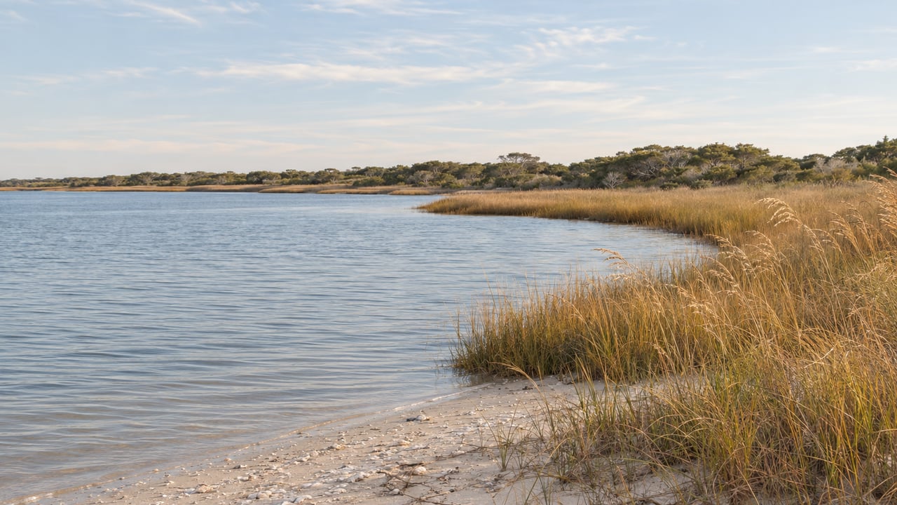
From Thanksgiving through New Year's, every drive down Anderson Boulevard in Topsail Beach passes three pieces of a 1940s Navy missile range within two blocks of each other. The building where the missiles were assembled sits on the sound at Channel Boulevard and Flake Avenue. The control tower stands at the corner of Anderson and Flake. The concrete pad the rockets were fired from is one block east, on the ocean side. The Missiles and More Museum inside the old Assembly Building has posted "Closed for the Season!" on its hours page. The rest of the exhibit is still out on the island, though, and much of it lines the road you already use to get to the grocery store.
That road is part of the story too. The Town of Topsail Beach's history page says the Army built a road and a floating bridge to the island during World War II, and the Navy took the island over after the war. When the Navy shut down the testing program in 1948 and gave the island back to its original owners, "the roads and bridge were left intact and so began the development of the island." The state historical marker at Flake Avenue says, "Observation towers line Topsail Island." So if you have guests in town over the holidays and the beach is too cold, you can drive the old range from end to end in an afternoon, using the towers as mile markers.
According to the Missiles and More Museum, the Navy ran secret tests here from 1946 to 1948. It built eight concrete observation towers and an assembly building to fabricate, launch and watch as many as 200 experimental rockets while scientists worked on the ramjet. The Town of Topsail Beach describes it as a joint project with Johns Hopkins University, with more than 200 missiles test fired.
Four stops sit close together at the south end, so park once and walk.
The Assembly Building at 720 Channel Boulevard is where ramjet rockets were fabricated and stored. It measures 77 by 82 feet, with reinforced concrete walls and floors, concrete block upper walls and timber trusses holding up the gable roof. Topsail Sound is right behind it. The building is listed on the National Register of Historic Places. A Talos missile stands outside the museum entrance, so you can see it even while the doors are locked for winter.
The Control Tower at 802 S. Anderson Boulevard, on the southwest corner of Anderson and Flake, is a three-story reinforced concrete building 16 feet square. Old photographs show it looking much as it does now. The rooftop observation platform is gone, and wide eaves and a flat roof now cover the observation deck. A family bought it in 1958 and turned it into a beach house. It's a private home, so look at it from the sidewalk.
The state historical marker stands at NC 50, which is Anderson Boulevard, and Flake Avenue, two blocks east of the Assembly Building. Its text credits the Navy with successfully testing ramjet engines in rocket flights from 1946 to 1948.
The launch platform is one block east of the Control Tower, across Anderson on the ocean side. It's now part of the 60-by-72-foot concrete patio between the buildings of the Jolly Roger at 800 Ocean Boulevard. Missiles were rolled on dollies from the Assembly Building to this spot for firing. The National Park Service's 1993 description says a reinforced concrete bunker under the platform was used as an observation post during launches and is now the motel's storage room. The town's history page confirms that the launch pad is now the Jolly Roger's patio.
If you'd rather walk than drive, the Historical Society of Topsail Island runs a free, one-mile "Historic Top Secret Walking Tour of Topsail Beach" through downtown.
When the National Park Service documented the towers in 1993, it measured Towers 1 through 6 from the same point, the intersection of NC 50 and NC 210 in Surf City. That intersection is still the center of the island for most of us, so the old survey works as a trip log.
| Tower | Address | Distance from NC 50 and NC 210 | Side |
|---|---|---|---|
| Tower 1 | 930 S. Anderson Blvd. at Hines Ave., Topsail Beach | 6.6 miles south | Sound |
| Tower 2 | Queen's Grant, Topsail Beach | 4.9 miles south | Sound |
| Tower 3 | 3008 S. Shore Dr. at Hispanola Ave., Surf City | 3.6 miles south | Ocean |
| Tower 4 | 1408 S. Shore Dr., Surf City | 1.6 miles south | Ocean |
| Tower 5 | 332 N. Shore Dr. | 0.4 miles north | Sound |
| Tower 6 | 408 Island Dr., former Ocean City Pier site, North Topsail Beach | 3.5 miles north | Ocean |
| Tower 7 | 3900 Island Dr. | Not measured in 1993 | Ocean |
The museum's Operation Bumblebee history says seven of the eight towers still stand. A few look much as they did when the Navy left, and some are now private homes. All of these are homes or sit on private lots, so view them from the road or the public beach, the way you'd view any neighbor's house.
From the car, the towers don't look much alike, and the reason is that each owner took a different route after the Navy left. Driving north from Topsail Beach, the differences become easy to spot.
Tower 1 at Hines Avenue had a two-story residential addition built onto it in 1949, just a year after testing ended. It was bought in 1991 and rebuilt over several years. The concrete addition was torn down in 1995, and the renovation was finished one week before Hurricane Fran in 1996.
Tower 2 is the one to point out to guests who want to see what the Navy built. In 1993 the Park Service described it as unaltered, and Mike Legeros's tower history quotes its description of the tower as "a lone sentinel overlooking Topsail Sound," on the west side of the island. A narrow channel separates it from the Queen's Grant development. It is listed on the National Register of Historic Places.
Tower 3 at Hispanola Avenue got a one-story residential wing and a wraparound porch on the ocean side in the 1950s. Hurricane Fran took the addition off in 1996. The StarNews photographed it in July 2025 and described it as standing at Surf City's southernmost point, with a historical marker nearby.
Tower 4 at 1408 S. Shore Drive has had the most varied history. In 1953 and 1954, hot dogs were sold on its first floor. After that it stood for years as a bare concrete skeleton between two larger houses, until it was renovated into a home in 1999. A spiral staircase now runs from the ground floor to the top.
Tower 5 at 332 N. Shore Drive, just north of the Surf City intersection, was renovated over about six years starting in 1994. A penthouse on top makes it one of the tallest buildings on Topsail Island.
Tower 6 was the center of a public fishing pier and restaurant built in the 1950s at the Ocean City Pier site. Our State reported that Hurricane Fran mostly destroyed the pier in 1996. The pier and the buildings around the tower were later removed. The tower stayed, and a home was built beside it.
Tower 7 at 3900 Island Drive is easy to drive past without seeing. It was turned into a 4,000-square-foot home around 1992, and the addition hides the tower from the street. You can see it from the beach. On a mild December day, that makes it a good reason for a beach walk.
The northernmost tower, known as the Jeffreys Tower, stood on undeveloped oceanfront in what was then West Onslow Beach. Its owner tore it down in 1989.
Your guests will probably ask why the Navy left, and the museum has the answer. In 1948 the program moved to White Sands, New Mexico, and Cape Canaveral, Florida, for better weather, less sea traffic and more range over open water. Years later, NASA used what it had learned building the Talos boosters when it designed the much larger solid rocket boosters for the space shuttle. That's a good fact to share at Tower 2 while everyone looks out over the sound.
The Assembly Building gets used once more before the year is out. The Historical Society's events calendar shows nothing for November. Its next event is the Jingle Bell Ball on Saturday, December 5, 2026, at the Historic Assembly Building, 720 Channel Blvd., with dinner, drinks and dancing to raise money for the Society. The Society's promotion says doors open at 6:30 p.m. and the evening runs until 10:00 p.m. For tickets, email [email protected]. The event is held in the building where the ramjets were put together, which is a fitting way to end a season of driving past the towers.
If you're hosting this Thanksgiving, here's an easy plan. Start at the Talos missile on Channel Boulevard and walk the two blocks to the marker and the Jolly Roger patio. Then drive north and check off the towers by mile, and finish on the beach looking for Tower 7. The Topsail Island neighborhood page and our earlier post on what changed at Topsail Beach's south end this fall have more ideas for the quiet months.
I love that so many of these towers became family homes, each one reworked by a different owner over seventy-some years. If you live in or are restoring a Topsail house with its own history and want a thoughtful eye on how to present it, the team at Holman Home Design and Real Estate would be glad to walk through it with you. Let's Connect.

Savannah Holman is a dedicated real estate professional who brings both personal insight and professional expertise to every client relationship. After experiencing the challenges of relocating with her own family through military orders, she developed a passion for making the home-buying and relocation process easier for others. With degrees in psychology and business, a background in corporate sales, and over eight years of real estate success with 500+ transactions, Savannah combines knowledge, compassion, and advocacy to deliver a seamless and positive experience. She is committed to treating every client like her first, ensuring their journey to a new home is both memorable and rewarding.
📍 110 Dungannon Blvd., Ste. 100, Wilmington, NC 28403
📞 (910) 799-3435


The building blocks that Savannah utilized to help create the experience that she wanted for her clients were instilled in her through lessons she learned from her family, mentors in her youth, and early career opportunities. Contact her today to find out how she can be of assistance to you!